Storm recovery does not end once the damaged materials are hauled away. Once the debris is gone, many homeowners start thinking about what comes next. Do they rebuild the same structure? Do they add a room, replace a fence, or change the layout? These decisions matter, and they often raise a new question: does the property need a fresh look before work begins?
A property survey is one tool that can help answer that question. It is not something every storm-damaged home needs. Whether one makes sense depends on the type of work planned, the condition of the property, and what the county or state requires for the project. This article walks through how storm damage can change what a homeowner needs to know about their land, and where a survey fits into that process.
When Storm Damage Changes the Question From Repair to Improvement
Fixing a damaged roof or replacing a section of siding is usually a repair. The home goes back to what it was before the storm. That kind of work rarely raises questions about property lines or site layout.
Rebuilding often looks different. A homeowner might decide to reconfigure the floor plan, move a wall, or build the structure a few feet from where it stood before. Others use the recovery period to add something new: a carport, a retaining wall, a driveway extension, or a second structure on the lot.
Once a project changes the property instead of just restoring it, the questions change too. Where exactly can the new structure sit? How close can it be to the property line? Are there setback rules that apply to the new configuration? These are not questions a homeowner can answer just by remembering where the old structure used to stand.
This is why it helps to figure out, early on, whether the planned work counts as a simple repair or something that changes the property. That decision affects what information the architect, engineer, or contractor will ask for before drawing up plans. Sorting this out before construction starts saves time later, when permits and inspections are involved.
The Existing Site May Need to Be Rechecked Before Plans Move Forward
Storms can leave more than damaged buildings behind. Fences may be knocked down. Retaining walls can crack or shift. Trees, sheds, and other landmarks that once marked the edges of a yard might be gone. Debris can cover the ground where reference points used to sit.
None of this changes where the legal property line actually is. A fence line moving, a wall collapsing, or a landmark disappearing does not move the boundary itself. What it can change is how easy it is to tell where things are without new measurements. Old site plans and survey records may no longer match what the property looks like today.
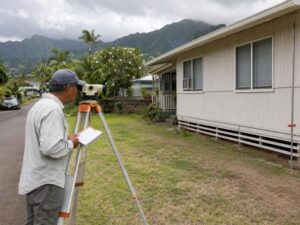
This matters most when a rebuilding project needs accurate information about where things currently sit. A surveyor can visit the site, take new measurements, and record the current conditions. That gives the design team something to work from that reflects the property as it stands now, not as it stood before the storm.
Where a Property Survey Fits Into the Rebuilding Team
A property survey is one piece of information among several that a rebuilding project may need. It does not replace the other pieces.
Architects use survey information to understand the shape and dimensions of the lot before drawing plans. Engineers may reference it when looking at drainage, grading, or structural placement. Contractors use it to confirm where they can build without crossing a boundary. Permit reviewers may ask for it as part of a complete application.
None of these professionals treat a survey as a stand-in for their own work. A survey does not evaluate the structural condition of a building. It does not design a floor plan. It does not review a project against building code. It gives the team a starting point: an accurate picture of the land itself, so the rest of the planning can move forward on solid information.
Hawaii Properties Can Add Another Layer to Recovery Planning
Location matters in Hawaii more than in many other places. Properties near the coast fall under extra rules that inland lots do not face. The state’s Special Management Area, often shortened to SMA, covers land close to the shoreline. Projects within this area may need additional review before construction can begin, separate from a standard building permit.
For homes along the shore, knowing where the shoreline itself sits can be an important part of planning. Shoreline location can affect what setback applies to a new or rebuilt structure, and that setback can determine how close to the water a homeowner is allowed to build.
This is not a hypothetical concern. After the 2023 Lahaina wildfires, Hawaii’s Department of Accounting and General Services sent state land surveyors to help oceanfront property owners. Their work involved confirming property boundaries and helping establish the information needed for shoreline certification, since many of the physical markers that once indicated property lines had been destroyed. That work was tied directly to the county permitting process. Property owners could not move forward with rebuilding permits until the boundary and shoreline information was in place.
This does not mean every property needs the same level of review. A home well inland, with straightforward repair or rebuild plans, may not run into any of these coastal requirements. But for oceanfront and near-shore properties, it is worth finding out early whether shoreline-related review applies to the project.
What Homeowners Should Confirm Before Ordering a Property Survey
Not every storm-damaged property needs a new survey, and not every survey needs to cover the same ground. Before ordering one, it helps to work through a few questions:
- What type of improvement is actually being proposed? A like-for-like repair carries different needs than a redesign or addition.
- Is there an existing survey on file, and is it recent enough to reflect the current project?
- Did the property experience significant storm damage that could affect the accuracy of older site information?
- Were fences, walls, or other reference features destroyed or moved?
- Does the architect, engineer, or permitting office require current survey information before they can proceed?
- Is the property near the shoreline or otherwise subject to Hawaii’s coastal land-use rules?
- What specific information does the design team actually need: boundary lines, topography, existing improvements, or something else?
- Would it help for the surveyor to coordinate directly with the architect or contractor before fieldwork starts?
Working through these questions helps match the survey to the project. A small repair with no boundary questions may not need one at all. A larger rebuild near the coast, with damaged reference points and new county requirements to meet, is a different situation. The right approach is the one that fits what the project actually requires, not the most extensive option available.
Frequently Asked Questions
Should I get a property survey before rebuilding after storm damage?
Not necessarily for every repair. Whether updated survey information makes sense depends on the proposed work, the property’s condition, and what the applicable authorities and project professionals require.
Can a property survey help when a storm has damaged existing site features?
Yes. When current site conditions matter to the proposed work, such as when fences, walls, or other reference points have been damaged or removed, a survey can provide updated field information for planning and design.
Does storm damage change my property’s legal boundaries?
No. Damage to fences, structures, landscaping, or other physical features does not by itself change a property’s legal boundary. The boundary stays where it was legally established, even if the visible markers are gone.